
Sussex County paddling splits cleanly into four kinds of water.
A sheltered cypress pond near Laurel. Two tidal water trails on Broad Creek and the Nanticoke River.
The shallow inland bays behind the barrier island. And a free marsh refuge near Milton.
This guide pulls over a dozen public launches, every fact sourced to its official page, into one place.
Scan the directory, check the Quick Answers, then read the card for the water that fits your trip.
Jump to a spot or water trail
- Trap Pond State Park: Trap Pond · Terrapin Branch Water Trail
- Broad Creek (Laurel): Roger C. Fisher Laurel River Park · Laurel Kayak/Canoe Launch · Edward Koch Access Area
- Nanticoke River (Seaford-Blades): Seaford Boat Ramp · Seaford Canoe & Kayak Launch · Oyster House & Riverwalk · Marina Park · Woodland Wharf
- Inland Bays & coast: Holts Landing · Assawoman Canal · Delaware Seashore bay launch · Fenwick Island bay side
- Prime Hook marsh: Prime Hook Canoe Trail
- Before you go · FAQ
Paddle-spot directory: quick comparison
| Spot | Best for | Essential stat |
|---|---|---|
| Trap Pond State Park (flatwater + rentals) | ||
| Trap Pond | First-timers, families | 90-acre pond / rentals on site |
| Terrapin Branch Water Trail | Cypress scenery | Nearly 9 mi of trails / paddle-in |
| Broad Creek (Laurel area) | ||
| Roger C. Fisher Laurel River Park | The Laurel paddle start | Accessible ramp / tidal Broad Creek |
| Laurel Kayak/Canoe Launch | Renters, guided trips | Hand-carry / no fee |
| Edward Koch Access Area | A turnaround point | Hand-carry / no fee |
| Nanticoke River (Seaford-Blades) | ||
| Seaford Boat Ramp | Mixed boat + kayak | 4-lane ramp / wide tidal river |
| Seaford Canoe & Kayak Launch | An easy town put-in | Hand-carry / no fee |
| Oyster House & Riverwalk Launches | Downtown paddle | Floating docks / no fee |
| Nanticoke River Marina Park | Blades launching | 1 ramp / 12 ft MLW |
| Woodland Wharf | Experienced paddlers | Dock launch / strong current |
| The Inland Bays & coast | ||
| Holts Landing State Park | Bay launching, crabbing | 2-lane ramp / Indian River Bay |
| Assawoman Canal | Sheltered protected water | 4-mi canal / kayak launch |
| Delaware Seashore bay launch | Inland-bay access | Bay-side launch / Rehoboth Bay |
| Fenwick Island bay side | Open-water carry-in | No formal ramp / Little Assawoman Bay |
| Prime Hook marsh (free) | ||
| Prime Hook Canoe Trail | Marsh birding by water | 7-mi trail / eastern portion closed |
How to use: the gray rows are the areas, in the same order as the sections below. The essential stat shows the water body and the access or craft, the two things that decide most paddling choices. Cards below add fees, current, parking and sources.
Quick Answers
- Free, no launch fee: the Laurel Kayak/Canoe Launch, Seaford Canoe & Kayak Launch, Oyster House and Riverwalk launches in Seaford, Edward Koch and Woodland Wharf access areas, and Prime Hook. Motorboats need Delaware registration or a ramp certificate at the Fish & Wildlife ramps; non-motorized boats are exempt.
- Easiest for first-timers: Trap Pond, a sheltered 90-acre pond, mostly 8 feet deep or less, with kayaks, canoes, paddleboards and pedal boats for seasonal rent on site.
- Rentals on site: Trap Pond State Park (seasonal concession) and the Laurel Kayak/Canoe Launch, where Quest Adventures runs guided paddles and kayak rentals.
- Best scenery: the Terrapin Branch Water Trail at Trap Pond paddles up close to the northernmost natural bald cypress in the United States; Broad Creek runs through forested cypress and sycamore swamp.
- Skip if you’re new: Woodland Wharf and the open Nanticoke mainstem at Seaford. The river is tidal with a strong current and the wharf sits beside an active cable ferry.
Trap Pond State Park: flatwater and rentals
Inland near Laurel, Trap Pond is the county’s beginner-friendly flatwater and its marquee paddling spot. It also draws hikers, so it shows up in both guides: the Bob Trail loops the same pond on land.
Trap Pond (the pond and rentals)
The quick take: a sheltered 90-acre pond, mostly 8 feet deep or less, created by damming a creek more than two centuries ago, and Delaware’s first state park, established in 1951.
- Kayaks, canoes, rowboats, pedal boats and paddleboards for seasonal rent from an on-site concession | launching ramp for shallow-draft boats
- Staff-led narrated pontoon tours on summer weekends and holidays, plus tours by appointment at the nature center
Best for: first-timers, families, calm water. Skip if: you want current or distance.
Rental and ramp facts come from Wikipedia, which also notes the seasonal concession. The Delaware State Parks Trap Pond page carries the activity details and current fee rates.
Terrapin Branch Water Trail
The quick take: nearly nine miles of marked canoe and kayak trails, with the Terrapin Branch route paddling up close to the bald cypress through the cypress swamp.
- One feeder stream is marked as a wilderness canoe trail
- Calm freshwater, signposted, the park’s signature paddle
Best for: scenery, the standout paddle. Skip if: you came for open distance or current.
The bald cypress here is the nation’s northernmost natural occurrence of the species, according to the National Park Service. Water-trail mileage is on the Delaware State Parks page. For the full paddle, the Trap Pond water trails guide covers the route, rentals and seasons in depth.
Broad Creek: the Laurel paddle
Broad Creek turns tidal in Laurel, a well-known largemouth bass fishery feeding the Nanticoke. The organizing spine here is one paddle: launch at Roger C. Fisher Park, run downstream to Edward Koch, and on toward Phillips Landing.
Roger C. Fisher Laurel River Park
The quick take: the main Broad Creek launch and the start of the Laurel paddle, roughly 3.5 miles one-way to Edward Koch and about 7 miles one-way to Phillips Landing.
- One accessible boat ramp, fishing pier, large floating dock, paved parking, seasonal restrooms | playground and picnic pavilion run by the Town of Laurel
- Managed by Delaware Fish & Wildlife; motorboats need DE registration or a ramp certificate, non-motorized exempt | tidal, current moderate to strong
Best for: the full Broad Creek run, beginner to intermediate over 2.5 to 5 hours. Skip if: you can’t read the tide; paddle with it, not against it.
The itinerary and launch details are on Paddle the Nanticoke, which also lists the park’s facilities and the launch coordinates, 38.5571, -75.5760.
Bethel Hole, a largemouth bass nursery on the route, is closed to fishing April 1 through June 30. Weekdays are easier in summer when motorboat and tournament traffic picks up. Paddlers report bald eagles, osprey, kingfishers, beavers and river otters along the way.
Laurel Kayak/Canoe Launch
The quick take: a non-motorized hand-launch upstream of Fisher Park, and the county’s other rental option.
- Floating dock with a ladder and a KayaArm stabilizer | gravel parking, no restrooms, no fee, run by the Town of Laurel
- Freshwater, current moderate with tide and wind
Best for: renters and guided trips, since Quest Adventures runs paddles and rentals on site. Skip if: you need restrooms or full accessibility; the wooden dock structure isn’t fully accessible.
The launch page covers the dock, the no-fee status and the on-site Quest Adventures rentals.
Edward Koch Access Area
The quick take: a hand-carry-only midpoint on the Broad Creek run, about 3.5 miles downstream of Fisher Park.
- No ramp or pier, limited parking, no restrooms, no fee, not ADA accessible
- Tidal, current moderate to strong, deep water
Best for: a turnaround or a shorter trip. Skip if: you need a ramp or facilities.
Access details are on the Paddle the Nanticoke page.
The Nanticoke River: Seaford and Blades
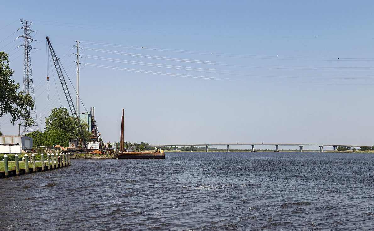
The Delaware segment of the Nanticoke is a 26-mile ecotourism water trail, contiguous with 37 more miles through Maryland to the Chesapeake Bay. It’s tidal and navigable to Seaford, with a strong current and a wide, wind-exposed mainstem. The full Nanticoke River paddling guide maps every access point and the Broad Creek route.
Treat the open mainstem with respect: it’s a strong-current, windy river, not a pond. The watershed holds the highest concentration of bald eagles in the northeastern United States. The trail counts over 25 public launches in all.
Seaford Boat Ramp
The quick take: four ramps plus a fishing pier on the wide Nanticoke mainstem, where wind can make paddling difficult.
- Floating docks, large paved lot, seasonal restrooms | Fish & Wildlife managed; motorboat registration or ramp certificate, non-motorized exempt
- Adjacent Riverview Park, run by the City of Seaford, has a picnic area
Best for: mixed bigger-boat and kayak launching. Skip if: it’s windy and you’re new; the river is wide here.
Facilities are on the Seaford Boat Ramp page (Map Segment 3).
Seaford Canoe and Kayak Launch
The quick take: a canoe and kayak hand-carry launch with a floating dock, and the calm Seaford put-in where the current is minimal.
- Minimal on-street parking, no restrooms, no fee, run by the City of Seaford
- Shallow at the launch, so it can be inaccessible at extreme low tide
Best for: an easy, no-fee town put-in. Skip if: you’re launching anything motorized.
The launch page confirms the no-fee, canoe-and-kayak-only access (Map Segments 2 and 3).
Oyster House and Riverwalk launches
The quick take: two free City of Seaford launches a long fishing pier apart, both with floating docks, for a downtown paddle with food and coffee at the dock.
- Oyster House: fishing pier, seasonal restrooms, small gravel and street parking, one block from High Street shops, connects to the Riverwalk
- Riverwalk: no parking, no restrooms, connected to Oyster House by the pier
Best for: a downtown Seaford outing. Skip if: the wind is up; both sit on the wide, strong-current mainstem.
The Oyster House launch page and the Riverwalk launch page carry the dock and access details.
Nanticoke River Marina Park (Blades)
The quick take: a one-ramp park in Blades with a floating dock and minimal current, in 12 feet of water at mean low water.
- Large paved lot, restrooms (entry code), picnic pavilion, showers and laundry | no launch fee, though slips and storage are paid
- Run by the Blades Economic Development Corporation; no fishing from the docks
Best for: an easy Blades launch onto calmer water. Skip if: you wanted to fish from the dock.
The Marina Park page lists the ramp, fees and facilities (Map Segment 3).
Woodland Wharf
The quick take: a kayak and canoe dock launch beside the active Woodland Ferry, on deep tidal freshwater with a strong current.
- Gravel lot with bike racks, seasonal restrooms, no fee, accessible | Fish & Wildlife managed
- Deep, typically 4 to 4.5 meters, current strong
Best for: experienced paddlers wanting the historic cable-ferry crossing. Skip if: you’re new; the site itself flags this launch as not recommended for those new to kayaking, given the current and the working ferry next to it.
The Woodland Wharf page carries the current warning and the ferry note. The 26-mile water-trail framing and the eagle and launch counts come from Wikipedia and the Nanticoke Watershed Alliance.
The Inland Bays and coast
Three shallow lagoons, Rehoboth, Indian River and Little Assawoman, sit behind the barrier island averaging 3 to 8 feet deep, per the Center for the Inland Bays.
These are open, wind-and-tide-exposed saltwater. A different game from the sheltered ponds.
Holts Landing State Park
The quick take: the only public boat and kayak ramp on the south shore of Indian River Bay between Millsboro and Indian River Inlet.
- Two-lane concrete ramp, rebuilt in 2016, open 24 hours, channel 60 feet wide by 4 feet deep, vessels to 25 feet | dedicated parking
- A 220-foot crabbing pier on site, and the Assawoman Canal runs through the park
Best for: launching onto the bay and crabbing. Skip if: the bay is whipped up; it’s open water.
Ramp and park details are on Wikipedia. Check the official Delaware State Parks page for current rates before you go.
Assawoman Canal
The quick take: a 4-mile no-lock canal linking Indian River Bay to Little Assawoman Bay, dug by hand in 1891 and dredged from 2006 to 2010, which Delaware describes as a haven for recreational kayakers.
- Channel 35 feet wide, 3 feet deep | runs through Holts Landing State Park
- Kayak launch at the Town Road trailhead, completed in fall 2020
Best for: a sheltered, protected-water alternative to the open bay. Skip if: you wanted the wide bay itself.
The canal history and dimensions are on Wikipedia, and the kayak launch and trail are on the DNREC Assawoman Canal trail page.
Delaware Seashore bay launch
The quick take: a public boat launch on the bay side near Dewey opens Rehoboth and Indian River bays to paddling, sailing and windsurfing.
- Open bay water | Indian River Marina sits in the same park at the inlet
- Launch confirmed, but lane count, exact spot and fee aren’t published; verify on the official park page
Best for: bay paddling with marina services nearby. Skip if: you want a documented, signposted kayak launch; the details are thin.
The launch and the bay activity list come from the park’s record.
Fenwick Island bay side
The quick take: the Little Assawoman Bay side of Fenwick Island State Park is open paddling water with no formal ramp.
- Carry-down access only | open, often breezy bay water
- No launch facility appears on the park’s record
Best for: paddlers happy to carry their boat down to the water. Skip if: you want a ramp, a dock or any facilities.
The bay side is described on the park page.
Prime Hook: paddling the marsh (free)
Prime Hook National Wildlife Refuge near Milton protects more than 10,000 acres, roughly 80 percent wetlands. It’s free, open daily from a half hour before sunrise to a half hour after sunset, with no entrance fee.
Prime Hook Canoe Trail
The quick take: a 7-mile one-way marsh trail for canoes, kayaks and motorboats under 25 horsepower, following Prime Hook Creek through red maple swamp and cattail marsh.
- Foord’s Landing and the Headquarters boat ramp are the two named access points
- Heavy mosquitoes, ticks and biting flies from June through September
Best for: marsh birding by water in spring and fall. Skip if: it’s high summer, or you wanted the full historic run; the eastern portion is closed.
The honesty note the listing sites miss: as of 2026 the eastern portion of the canoe trail is heavily silted and not recommended for canoes or kayaks. The U.S. Fish and Wildlife Service advises going only west from Foord’s Landing.
You cannot reach the Headquarters boat ramp by water. That closure was read live on the refuge page in June 2026.
Before you go
Four things change often enough to check every time.
Fees and launches. At Fish & Wildlife ramps, motorboats need Delaware registration or a ramp certificate, while non-motorized boats are exempt; the hand-carry and town launches are free. A Delaware fishing license is required if you fish. Current state park rates are on the official Delaware State Parks site.
Tides and current. Broad Creek and the Nanticoke are tidal with a strong current, so paddle with the tide and check charts first. The pond and the canal are the calm-water options.
Rules differ park by park. Check the one you’re visiting, not the one you visited last.
Rentals. Trap Pond runs a seasonal concession, and Quest Adventures rents at the Laurel launch. Both are seasonal, so call ahead.
Seasons and bugs. Bethel Hole’s bass nursery is closed to fishing April 1 through June 30, Prime Hook’s bugs peak June through September, and weekdays are easier on Broad Creek in summer.
The shoulder seasons are when this county is at its best.
Frequently asked questions
Where can you rent a kayak or canoe in Sussex County, Delaware?
Trap Pond State Park rents kayaks, canoes, rowboats, pedal boats and paddleboards seasonally from an on-site concession. Quest Adventures offers guided paddles and kayak rentals at the Laurel Kayak/Canoe Launch on Broad Creek.
Where is the best place to kayak for beginners in Sussex County?
Trap Pond is the sheltered, beginner-friendly choice: calm water, mostly 8 feet deep or less, rentals on site, and nearly nine miles of marked trails. Avoid the open tidal Nanticoke mainstem and Woodland Wharf until you have current experience.
Can you kayak the Nanticoke River and Broad Creek?
Yes. The Delaware segment of the Nanticoke is a 26-mile ecotourism water trail with more than 25 public launches. Broad Creek has a popular 7-mile paddle from Roger C. Fisher Laurel River Park down to Phillips Landing.
Both are tidal with a strong current. Check tide charts and paddle with the tide.
Is the Prime Hook canoe trail open?
Only partly. As of 2026 the eastern portion of the 7-mile canoe trail is heavily silted in and not recommended for canoes or kayaks. The U.S. Fish and Wildlife Service advises going only west from Foord’s Landing.
You cannot reach the Headquarters boat ramp by water. The refuge is free and open daily.
Where can you launch a kayak on the inland bays?
Holts Landing State Park has the only public boat and kayak ramp on the south shore of Indian River Bay between Millsboro and Indian River Inlet. The Assawoman Canal also runs through the park, which Delaware describes as a haven for recreational kayakers.
Do you need a permit to kayak in Sussex County?
Non-motorized boats are exempt from the ramp certificate that motorboats need at Delaware Division of Fish and Wildlife launches. The hand-carry and town launches charge no fee. A Delaware fishing license is required if you fish.
Related guides
For dry-land trips in the same county, the full guide to hiking trails in Sussex County covers the Bob Trail around this same Trap Pond cypress swamp.
For park fees, comparisons and facilities across the county’s public land, see the guide to Sussex County’s state parks and public lands.
For a directory of every public put-in, the guide to kayak launches in Sussex County lists each access point with its type and fees. To rent a boat, the kayak and canoe rentals guide covers every operator in the county.
Records Pond, also called Laurel Lake, on Broad Creek is a popular local recreation lake, though no public paddling launch is documented on official sources.
Photos: Famartin (CC BY-SA 4.0) and Acroterion (CC BY-SA 4.0), via Wikimedia Commons.
Last verified: 2026-06.