Fact box
- Length / route type: point-to-point, roughly 5.8 to 8.3 miles depending on which source and which segments you count (see the route section below)
- Surface: mix of asphalt, concrete, and crushed stone
- Difficulty: rated easy and mostly flat
- Parking and fees: several trailheads; the Wolfe Neck Road lot sits inside Cape Henlopen State Park and needs a park pass or entrance fee, while the high school and Tanger Outlets access points do not. Current rates are on the Delaware State Parks site
- Restrooms / facilities: at the Wolfe Neck Road and Lewes Library trailheads, off Pilottown Road, and at Grove Park in Rehoboth
- Dogs: allowed on leash
- Official source: Delaware Greenways
- Last verified: 2026-06
The Junction & Breakwater Trail is the easiest way to travel between Lewes and Rehoboth Beach without a car. It runs flat on a rail-trail through forest, farmland, and coastal marsh along the old Junction & Breakwater Railroad bed. This guide pulls the practical details, distances, parking, fees, and dog rules from the official sources that publish them.
What you’ll see on the route
The trail is point-to-point, not a loop, so a full one-way walk needs a turnaround or a shuttle. It runs between Gills Neck Road in Lewes and the west side of Rehoboth Beach.
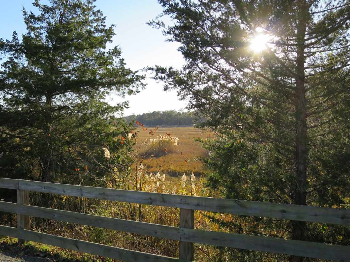
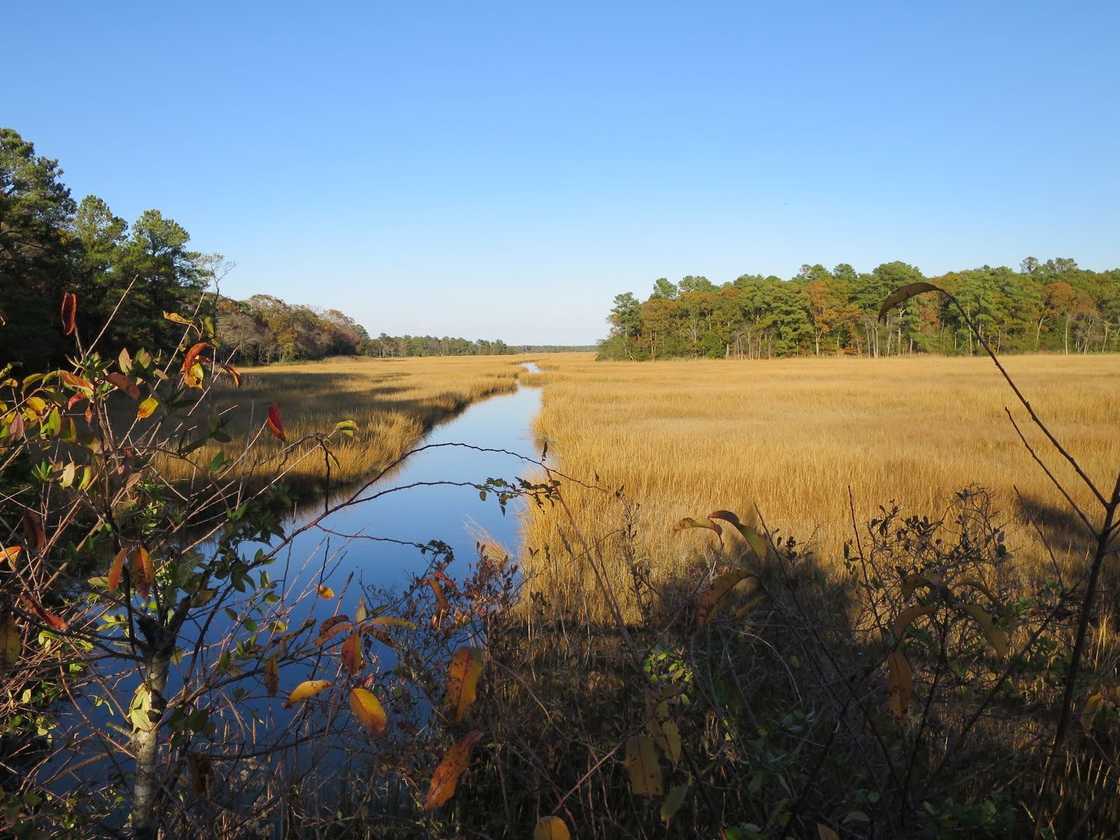
According to Delaware Greenways, the route winds through hardwood and pine forests, open fields, and coastal marshes. The middle section is the most rural. According to TrailLink, the northern stretch weaves through suburban backyards while the central section runs through farmland and woods.
The scenic high point is an 80-foot railroad bridge over Holland Glade, built in 1913. Delaware Greenways describes it as an overlook with views across the coastal marshes. From the bridge you can also spot a World War II observation tower inside Cape Henlopen State Park.
Interpretive signs along the way cover local history, plants, and wildlife of the Delaware coast.
At the Rehoboth end, the trail crosses the Lewes & Rehoboth Canal on the Rehoboth Avenue drawbridge, where bollards separate users from road traffic. It then turns north along the canal’s east shore into Grove Park.
Grove Park is the southern terminus, with a playground, picnic pavilions, fitness stations, restrooms, water fountains, and the Rehoboth Visitors Center. That visitor center is the town’s restored old train station, a fitting bookend for a rail-trail.
Why the length varies by source
You’ll see three different distances for this trail, and all of them are correct for what they measure.
- 5.8 miles is the Delaware Greenways figure, covering the off-road trail section. Greenways notes the trail portion ends at Holland Glade Road and continues as bike lanes and shared-use paths into Rehoboth near Grove Park.
- 8.3 miles is the TrailLink figure for the complete end-to-end route, from 300 Gills Neck Road to Church Street in Rehoboth Beach. That includes the on-road segments through West Rehoboth along Canal Crossing Road.
- About 5 miles is the park-corridor section reachable from the Wolfe Neck and Holland Glade trailheads, per the Delaware State Parks page.
The natural, off-road part is roughly 5 to 6 miles. The full marked route to downtown Rehoboth is a bit over 8.
Parking, restrooms, and the fee situation
The fee question catches people out, because part of this trail sits inside a state park and part of it doesn’t.
The Wolfe Neck Road trailhead is inside Cape Henlopen State Park, so parking there needs a park pass or entrance fee. It has parking, restrooms, a water fountain, and a bike repair station. Current rates are on the Delaware State Parks site.
The other main access points don’t sit in the fee area:
- Cape Henlopen High School (Lewes): parking with trail access off Kings Highway, no fee noted at this point.
- Tanger Outlets / Holland Glade Road: park behind the outlets off Holland Glade Road (also called Seaside Outlet Drive). A short bike-and-pedestrian path between the buildings leads to the trail.
- Lewes Library Trailhead: about a quarter mile from the Gills Neck Road start, with restrooms, water fountains, an information kiosk, a bike station, and plenty of parking, per Delaware Greenways.
- Gills Neck Road end: a bicycle parking area and information kiosk sit at the corner of Gills Neck and Savannah Road.
Restrooms and water mid-trip: facilities are off Pilottown Road near Lewes and at Grove Park at the Rehoboth end.
A note on surface for anyone bringing a road bike or a stroller: most of the trail has been paved in recent years. The Wolfe Neck Road section was still hard-pack crushed stone as of August 2025, per a TrailLink reviewer. The southern section through West Rehoboth is paved asphalt.
A rail line older than Rehoboth’s tourist trade
The trail’s name comes from the Junction & Breakwater Railroad, chartered in 1857 to run from Harrington toward the Atlantic coast. According to TrailLink’s trail history, it was a subsidiary of the Old Dominion Steamship Company, feeding steamship service between Delmarva and New York.
Construction stalled during the Civil War, resumed in 1867, and reached Lewes by way of Georgetown in 1869. Service opened to Rehoboth Beach in 1878. The town had been founded just five years earlier in 1873 as a Methodist camp-meeting site that grew into a resort.
The line changed hands repeatedly, eventually folding into the Pennsylvania Railroad’s Delmarva Division. Passenger service held up until the Great Depression, rallied briefly during World War II, then lost out to highways and cars. The PRR ended most Delmarva passenger service by 1950.
The right-of-way you walk today is what was left after the trains stopped running.
After the PRR became Penn Central in 1968 and went bankrupt in 1970, the company abandoned 5.5 miles between Lewes and Rehoboth Beach. That abandoned right-of-way became this trail, built from unused rail lines in the early 2000s and opened to the public in 2003. Delaware Greenways notes it’s now a designated National Recreation Trail.
Connections and longer outings
This trail is a hub, not a dead end, which is part of why it’s worth knowing.
At the Gills Neck Road endpoint it meets the Georgetown-Lewes Trail, an asphalt rail-trail on the former Delaware Coast Line Railroad bed. As of 2024 the Georgetown-Lewes Trail had eleven miles open, with plans to reach 17 miles linking Lewes and Georgetown, per Delaware Greenways.
At the Rehoboth end, a signed route guides users toward Gordons Pond Trail, an alternative path back toward Lewes through Cape Henlopen State Park. Both trails are part of the same Cape Henlopen network, and the full Gordons Pond guide covers its boardwalks and birdlife in detail.
Combine this trail with the park’s other routes and you can build a loop of roughly 18 miles, according to a TrailLink user. The park’s own 3.8-mile paved Bike Loop ties into the system too.
For the wider picture of where this fits among the county’s trails, see the full Sussex County hiking guide.
Seasonal notes
The trail is open year-round, with no seasonal closure of its own. The nearby Cape Henlopen ocean beaches have spring and summer restrictions, but those apply to the beach, not to this trail.
Shade is the thing to plan around. The forested and wetland central section stays cool, but the open stretches through housing developments can get hot in summer.
One TrailLink reviewer called the heat brutal there in May. The same reviews describe road crossings as well-marked with warning lights and motorists as respectful.
On warm days the trail gets busy with both tourists and locals, so early mornings are quieter. Even then, reviewers call it a peaceful break from the traffic on nearby Route 1.
Frequently asked questions
How long is the Junction & Breakwater Trail?
It depends on what you count. Delaware Greenways lists 5.8 miles for the off-road trail section. TrailLink lists 8.3 miles for the full end-to-end route from Gills Neck Road to Church Street in Rehoboth Beach, including on-road segments.
The state park describes the park-corridor portion as about 5 miles.
Do you have to pay to use the Junction & Breakwater Trail?
The trail itself is free. The Wolfe Neck Road parking area sits inside Cape Henlopen State Park and needs a park pass or entrance fee.
The Cape Henlopen High School and Tanger Outlets access points are outside the fee area. Check the Delaware State Parks site for current rates.
Are dogs allowed on the Junction & Breakwater Trail?
Yes, dogs are allowed on leash year-round. Delaware Greenways and TrailLink both stress trail etiquette because of the heavy use from walkers, runners, cyclists, wheelchair users, and families with strollers. For leash rules and seasonal beach bans across the county, see the dog-friendly trails and beaches guide.
Is the Junction & Breakwater Trail paved?
Mostly. Most of the trail has been paved in recent years. The southern section through West Rehoboth is asphalt, but some hard-pack crushed stone remains.
The Wolfe Neck Road section was still crushed stone as of August 2025.
What is the railroad bridge on the trail?
It’s an 80-foot railroad bridge over Holland Glade, originally built in 1913. It now serves as an overlook with views over the coastal marshes and a World War II observation tower inside Cape Henlopen State Park.
Photos: Art Anderson, trail path and salt marsh (CC BY-SA 3.0), via Wikimedia Commons.
Last verified: 2026-06.